Car Free Megacities

Can you imagine London, Paris and New York free from car dependency?

Scroll down to explore the consequences of car use in these cities
and discover what they could gain by going car free.

IMG_9555.jpeg

Data Dashboard

Map of London showing 61.8% living car free in inner London and 33.0% living car free in outer London
Map of Paris showing 66.4% living car free in inner Paris and 37.0% living car free in outer Paris
Map of New York with Manhattan showing 77.6% living car free, and the rest of the city showing 48% living car free
Pictogram showing London with 10.9 traffic fatalities per year per million population, Paris with 14.6 and New York with 29.3
Bar chart showing the population of inner and outer metro areas. London has the highest total population and share of inner, New York has the second largest population and lowest share of inner, and Paris is third in total population.
Map of London showing green space in the city
Map of Paris showing green space in the city
Map of New York showing green space in the city
Chart showing average PM2.5 air pollution. Paris has the most, then London, then New York. All three cities are above the WHO target.
Map showing that 31.3 sq km of space in London is taken up by cars
Map showing that 31.3 sq km of space in Paris is taken up by cars
Map showing that 34.8 sq km of space in New York is taken up by cars
Bar chart showing that 119 hours are lost during rush hour per person per year in London,. 144 in Paris, and 123 in New York
Donut charts showing that 33% of London journeys, 45% of Paris journeys and 31% of New York journeys are made on foot.
Bar chart showing daily trips made by public transport and bicycle in London, Paris and New York. London has the highest bike trips, and Paris has the highest public transport trips.
Bubble chart showign trips made on bike-sharing schemes per year, per million population. London has 1.1 million, NYC has 2.4 million, and Paris has 5.2 million
Donut chart showing the percentage of city CO2 emissions coming from road transport. Greater London is 28%, Greater Paris is 30% and New York City is 24%

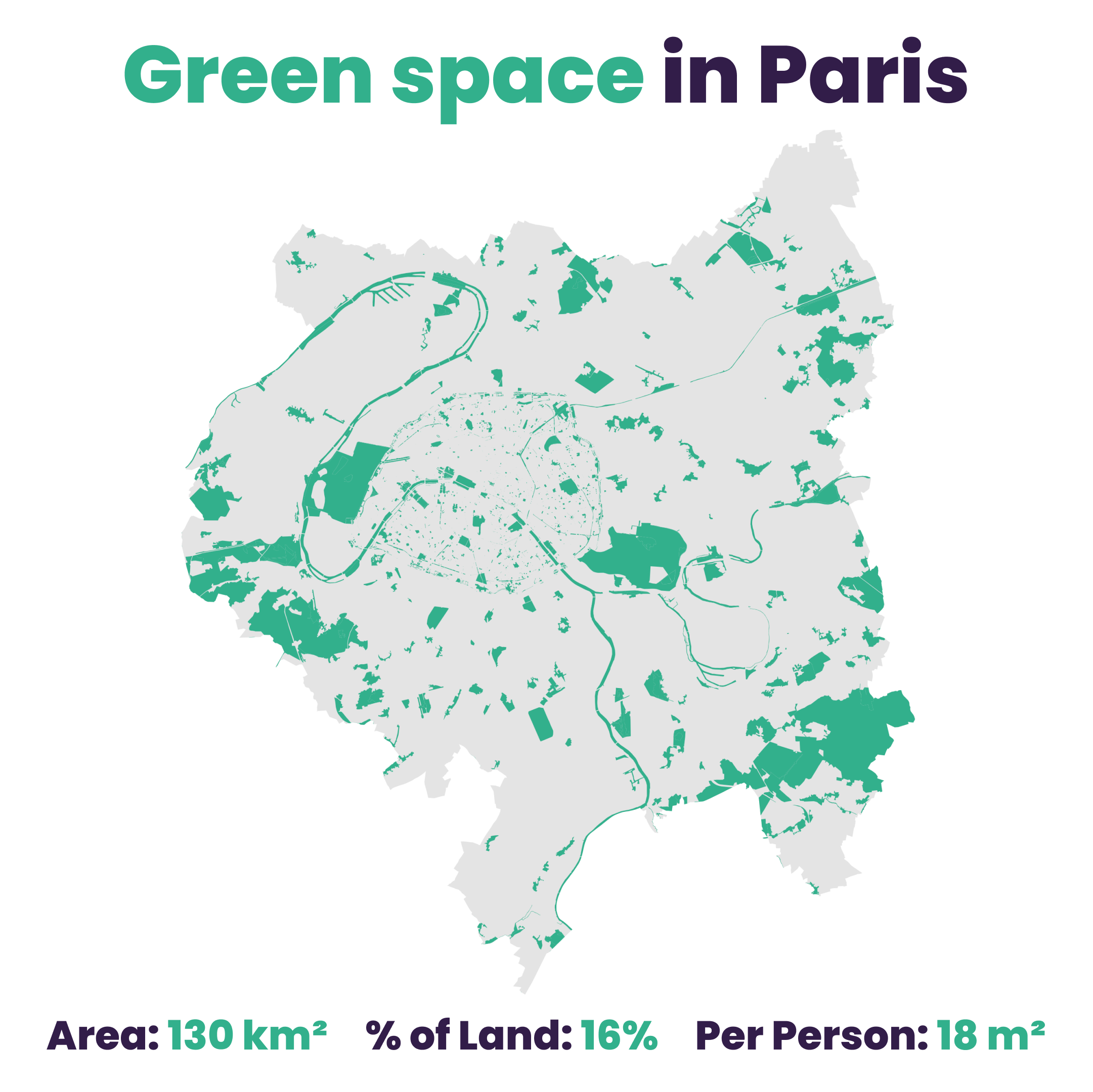
Data and sources for these charts can be found in the Car Free Megacities datasheet. You can also view the methodology behind these statistics.